Trail Running calendar near Boreham 2026-2027
We have found 492 Trailruns within 80 miles of Boreham. See below where and when you can find the races.
We have found 492 Trailruns within 80 miles of Boreham. See below where and when you can find the races.
A mixed road and country run around Ousden in Suffolk offering 5k, 10k, half, full and ultra options with loop and out-and-back formats, regular aid stations, onsite parking and bespoke finisher medals.
A *10 km* out-and-back race through gravel paths and woodland at Weald Country Park in Brentwood, organised by MCC Promotions. The event includes on-day registration, water stations, prizes and supports the charity Sport In Mind.
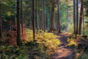
A forest trail event at Wendover Woods offering a hilly multi-lap 10 km course with Half Marathon, 10k and Junior Run options, on-site facilities for spectators, route maps and GPX files, and medals plus free photos for participants.
An urban ultramarathon from a central London Run HQ with three distances including a 100km route that visits 100 plus landmarks. The event emphasises accessibility, on-course checkpoints, medals and a Top 100 finishers list.
A 100 mile off-road ultra at Denbies Wine Estate on 19 June 2027 using a flat one mile loop, full chip timing and multiple race options including 50 and 75 miles plus timed events.
At Denbies Wine Estate on 19 June 2027 runners complete one mile on the hour for 24 consecutive hours. The attended event includes chip timing, onsite tent camping and a substantial finisher medal and runs alongside a virtual option.
A timed endurance event at Denbies Wine Estate where participants run one mile on the hour for 12 consecutive hours. Attended and virtual options run simultaneously and places for the attended event are limited.
A 5k obstacle course at Trinity Park with muddy climbs, crawls and slides, held in staggered waves. The grassy course is fairly flat and the event requires participants to be 13 or older.
A scenic trail half marathon on National Trust land at Dunstable Downs covering 21.2 km and 450 m elevation. The fully marked course has two aid stations, GPX files available and event facilities at the National Trust centre.