Trail Running calendar near Park 2026-2027
We have found 35 Trailruns within 80 kilometers of Park. See below where and when you can find the races.
We have found 35 Trailruns within 80 kilometers of Park. See below where and when you can find the races.

Solo mountain running across three relay legs in County Wicklow, covering 49.0 km and 2,170 m ascent. The unmarked route forbids GPS and requires Level C mandatory kit with checkpoints and cutoffs in place.
Women only night trail in County Wicklow on 2 October 2026. The fully marked 7.00 km route follows the Sugarloaf Way, requires a head torch and trail runners, and entry fees will be donated to Bray Women's Refuge.
Test your navigation skills in County Wicklow at the second race of the annual Nav Challenge league. Navigate an unmarked course through the Irish mountains using traditional methods without GPS assistance.
Nav Challenge 3 is the fourth race of the Navigational Challenge league in County Wicklow on 11 October 2026. The route is unmarked, GPS is not allowed, and participants must carry mandatory Level B kit.
A *10 km* trail run in County Wicklow that uses coastal cliff paths and forest trails. Part of the Gaelforce 10K series, the event provides route details, advice, accessibility information and results.
IMRA AGM 2026 Race is set for Saturday 21 November 2026 in County Wicklow. The long course is listed as 99.00 km with 999 m climb, while route and entry details remain to be confirmed.
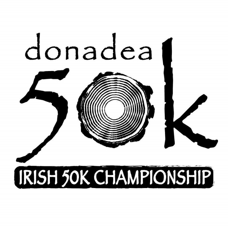
A 50 km ultramarathon at Donadea Forest Park hosted by Donadea Running Club, listed to return on Saturday, February 13. Early-bird places were sold out and deferrals or refunds were allowed until December 31.
A trail running event in Bray, County Wicklow featuring a 10 km course on forest tracks instead of tarmac. Scheduled for 3 April 2027, it is open to participants aged 16 years and above and is part of the Gaelforce 10K trilogy.